


Plus get our latest book recommendations, author news, and competitions right to your inbox.
Published by Olive Branch Press
Distributed by Simon & Schuster
Table of Contents
About The Book
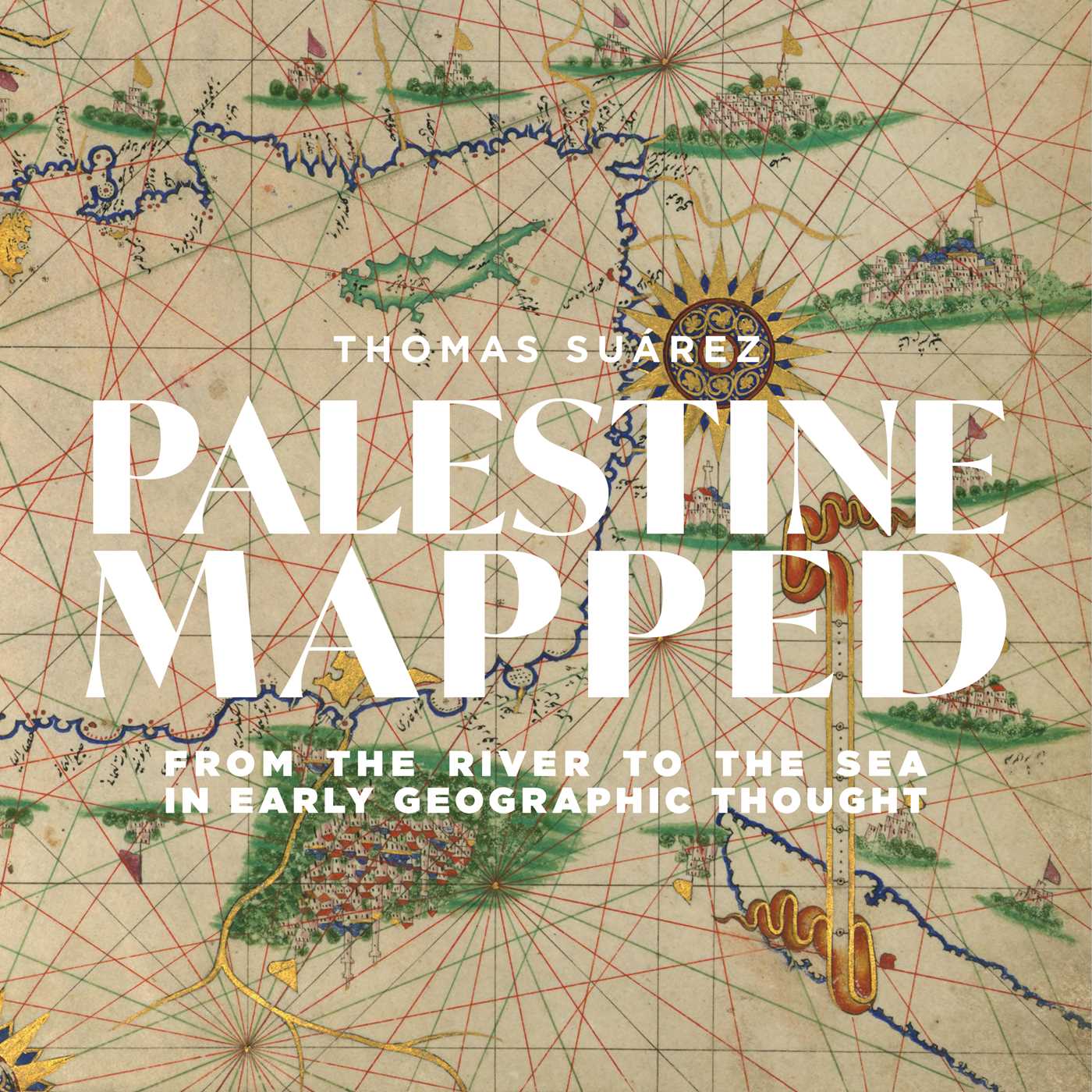
A lavishly illustrated and meticulously guided excursion through the mapping of historic Palestine from the earliest record through to the twenty-first century.
Palestine is as much a place in the psyche of those who mapped it as it is a region of the earth. An authority on the history of cartography who has also written extensively on Palestine, Thomas Suárez is uniquely qualified to address the mapping of this region “from the river to the sea.”
Richly illustrated, Palestine Mapped guides the reader through the Greek and Roman concepts of Palestine, those of various medieval Mediterranean civilizations, and the European “Holy Land” mapping that has dominated for half a millennium and continues to inform modern political thought. Suárez dissects that prevailing mindset rather than viewing the land through its lens, setting the book apart from all others on the mapping of the region.
Product Details
- Publisher: Olive Branch Press (January 13, 2026)
- Length: 248 pages
- ISBN13: 9781623716158
Browse Related Books
Raves and Reviews
“A remarkable book, a unique and powerful survey of the mapping of Palestine. Most importantly for the present, the book shows how ‘mapping’ gave an image of veracity to the European Orientalist mindset, its perception of Palestine that informed later colonial conquest...a wonderful feast of search, inquiry, and analysis.”
– Salman Abu Sitta, founder of Palestine Land Society
“This is a gem of a book. Part geography, part history, part political analysis, it is written with a fine understanding of what is at stake in mapping Palestine. Nothing like this has ever been produced by any previous researcher.”
– Ghada Karmi, author of Murjana and In Search of Fatima: A Palestinian Story
“Suárez’s provocative cartographic history illustrates that religious, economic, and political motivations have heavily influenced the mapmaking of Palestine. A beautifully illustrated, deeply researched account.”
– Booklist, starred review
“Tom Suárez offers a unique cartographic representation of Palestine, the land with people, coveted by foreigners, colonized by Europeans and gradually destroyed by Zionism. Beautifully produced, it gives hope that human made maps will one day represent liberation and freedom for everyone between the river and the sea.”
– Ilan Pappé, historian and author of The Ethnic Cleansing of Palestine
“In this magisterial study of Holy Land mapping history, Thomas Suárez brings his extensive cartographical knowledge of historical geography to examine the successive periods of Palestine maps from the early Roman, Byzantine, Arab, Crusader, and Ottoman periods, to the dawn of imperial surveys serving European interests through pilgrimage, trade, and intelligence. Of particular interest to the reader is the author’s extensive study of the mosaic Madaba Map, probably the oldest map of Palestine going back to the 6th century Byzantine period, indicating key locations in Jerusalem, Hebron, and the coastal region.”
– Salim Tamari, Emeritus Professor of Sociology, Birzeit University
“A stunningly beautiful & meticulously researched compendium of Palestine maps across the millennia. Dedicated to the Palestinians slaughtered in Gaza, the author Thomas Suarez, a London-based musician & cartographer, is a former member of Palestine’s National Conservatory of Music. Congratulations to the Interlink Foundation for undertaking such a poignant enterprise.”
– Prof. Walid Khalidi, Harvard University
Resources and Downloads
High Resolution Images
-
Book Cover Image (jpg): Palestine Mapped
Hardcover 9781623716158


